Why in News?
The United Nations General Assembly (UNGA) has adopted the “Correct the Map” resolution, calling for greater use of a world map that represents the actual relative size of continents, particularly Africa. The resolution, sponsored by Togo and backed by African Union (AU) members, received support from 164 countries. The United States voted against it, while six countries abstained.
The resolution is non-binding, but it is expected to encourage UN bodies and other institutions to reconsider the maps they use.
Why Is the Mercator Map Controversial?
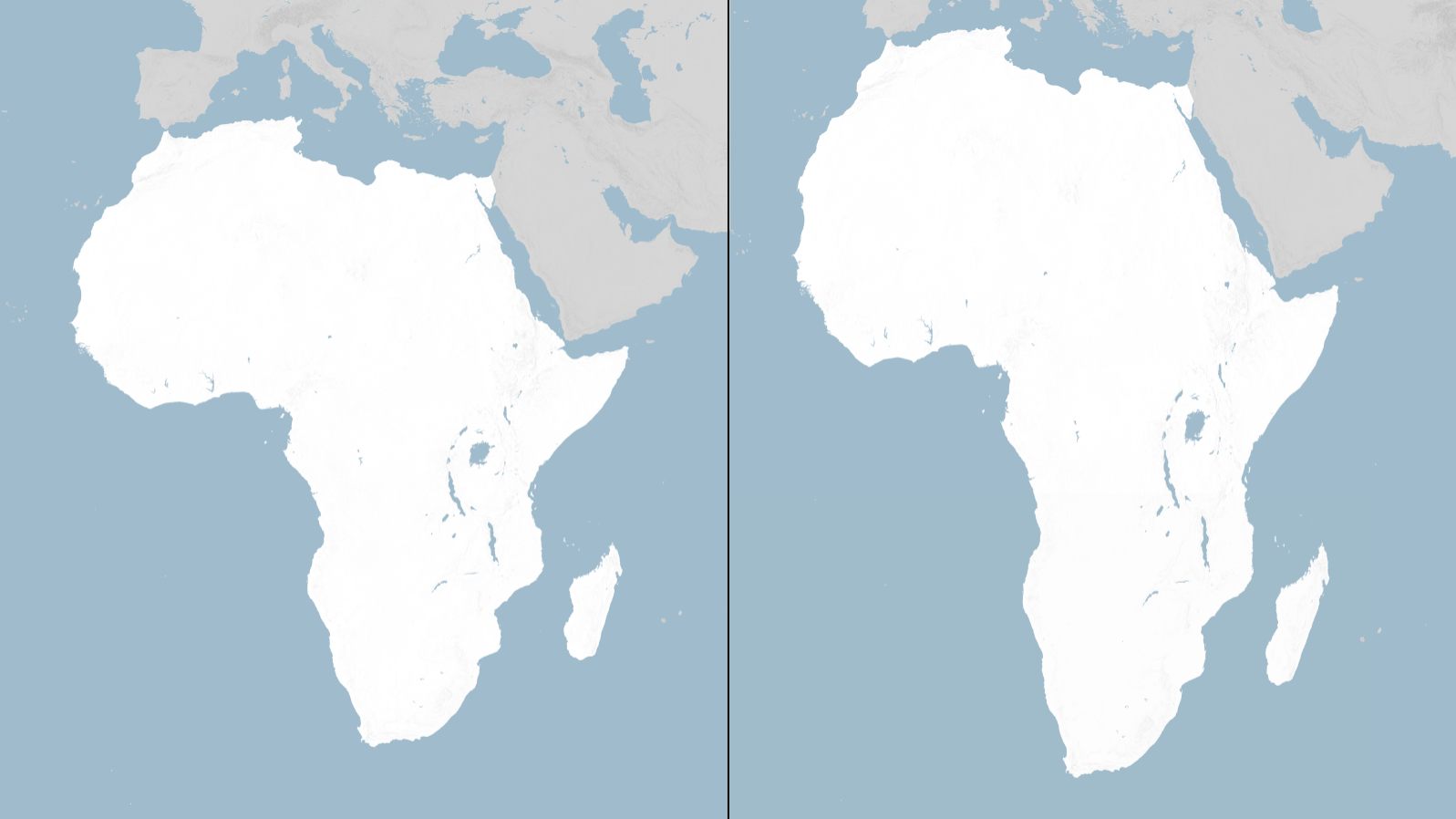
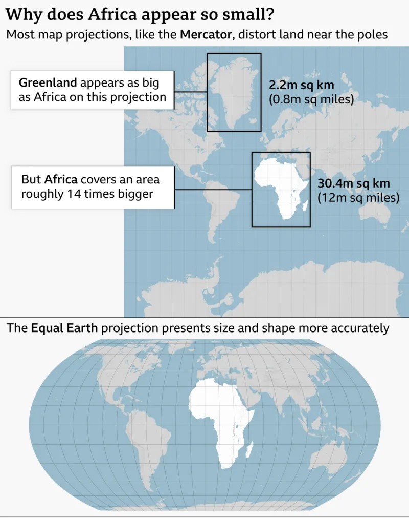
The Mercator projection created by Flemish cartographer Gerardus Mercator in 1569 is one of the world's most widely used map projections. However, it significantly distorts the size of landmasses:
- Areas closer to the Equator appear smaller than they actually are.
- Areas closer to the poles appear much larger.
- Greenland can appear almost as large as Africa even though Africa is about 14 times larger.
- Such visual distortion can influence how people perceive the geographical, economic and strategic importance of different regions.
Equal Earth Projection
- To address the problem of representing land areas more accurately, cartographers developed the Equal Earth projection in 2018.
- Unlike the Mercator projection, Equal Earth is an equal-area projection, meaning it preserves the relative sizes of landmasses more accurately.
- The African Union’s 54 member states adopted the Equal Earth projection in February 2026, supporting its use as a more proportionally accurate representation of the world's continents.
Why Does the Map Matter?
Supporters of the resolution argue that maps are not merely geographical tools; they also influence how people understand the importance, size and potential of different regions.
For Africa, the campaign highlights the continent’s:
- Vast geographical area
- Large and growing population
- Natural resources
- Economic and investment potential
- Togo’s Foreign Minister Robert Dussey described a fair map as part of a fairer representation of the world.
Opposition to the Resolution
- The United States was the only country to vote against the resolution.
- US representatives argued that the UN General Assembly should focus on more pressing issues related to international peace, prosperity and global relations, rather than historical map projections.
Key Takeaway
The UN resolution highlights the difference between map projection and geographical reality. While no two-dimensional map can perfectly represent a three-dimensional Earth, the move towards equal-area projections such as Equal Earth seeks to reduce the distortion of continental sizes, particularly Africa’s.