Why is it in the news?
→ Remote sensing is gaining importance for mapping and managing Earth’s natural resources using satellite-based insights.
→ The article highlights India’s IRS Programme and expanding applications in agriculture, water, minerals, disaster management, and governance.
Category: S&T
Important Points
- Remote sensing observes Earth from space/air using satellites and drones detecting reflected/emitted electromagnetic radiation.
- NDVI uses red and near-infrared reflectance to assess crop health; higher NDVI indicates healthier vegetation.
- NDWI and Modified NDWI are used for surface water detection; MNDWI improves urban water mapping.
- SAR enables flood mapping during clouds/night; calm water appears dark in radar images.
- Hyperspectral sensors identify minerals like copper, gold, lithium, limestone, and granite.
- Gravity-measuring satellites estimate groundwater storage; severe depletion noted especially in North India due to excessive irrigation.
- Remote sensing supports coral bleaching, mangrove monitoring, shoreline erosion, oil spill tracking, and Blue Economy.
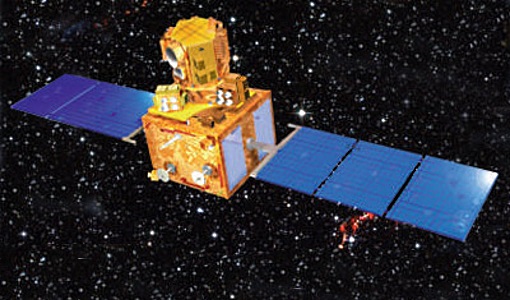
- Indian Remote Sensing (IRS) Programme began with IRS-1A in 1988; operated by ISRO with one of the world’s largest constellations.
- IRS applications include agriculture, water resources, urban planning, forestry, mineral exploration, disaster management, ocean studies, and environmental monitoring.
- Key missions include Resourcesat series, HysIS, Oceansat, Megha-Tropiques, SARAL, Cartosat series, RISAT, RISAT-1A, RISAT-2A, and NISAR.
- Bhuvan Geoportal supports national geospatial visualization and planning.
- Under PMKSY-WDC 2.0, around 1,150 projects assessed using Cartosat-2S and Cartosat-3 data.
- Challenges include data cost, cloud cover, limited last-mile application, skill gaps, data fragmentation, and privacy/security concerns.